Monitoring our planet from above: exciting and versatile study and career paths
What is the condition of our forests and coral reefs; which areas are biologically diverse and should be protected? Earth observation is a rapidly growing discipline and can help solve grand challenges through the analysis of remote sensing data acquired by satellites, aircrafts and drones.

Earth observation is a mix of science and technology and brings together people from diverse backgrounds. Engineers, environmental scientists, mathematicians, geographers, foresters, .. work together to develop different phases of the Earth observation chain: satellite and sensor technology, data transfer and storage, programming, data analytics and interpretation, field measurements, and finally, outreach to decision-makers and the general public. There is no single “right” educational path to becoming a student in this field, though an interest in STEM subjects is a clear advantage.
The life of a student studying Earth observation (or remote sensing, as it is often also called) is exciting. Most satellite data used for monitoring the environment are now freely available on the internet, and so are computer software. Making archeological discoveries or creating global maps of vegetation and its changes during the past 40 years are already within reach on your laptop, thanks to cloud computing. Playing around with remote sensing methods can easily be done also outside classes. Scientific publications are commonly openly accessible, so you have direct access to the latest theories and methods of remote sensing and can build a strong base for your career. Satellite data availability and cloud computing opportunities have shot up even during the past five years. Sounds amazing, doesn’t it?
The job market for remote sensing experts is growing. Every year, new satellite missions are being planned, satellites launched, processing tools created. The sheer amount of data is increasing very rapidly, and data processing tools and techniques become more numerous and specialized. This means that the demand for experts who can interpret and utilize all these data and tools is also increasing. The growing availability of satellite data also means that more people will encounter satellite data in their everyday lives. Remote sensing specialists work for organizations such as FAO, ESA or NASA, as well as in governmental agencies or NGOs conducting operational environmental monitoring. It’s also possible to establish a start-up company: examples of such success stories linked to Aalto University are Terramonitor and Iceye. Working towards a doctoral degree and embarking a career in academia is also common amongst remote sensing specialists. A scientific career can lead you to mastery in problem solving and data interpretation, all while creating a meaningful impact on the world.
Last but not least: our planet Earth looks very beautiful from above at different spatial scales. You would not want to miss that sight!
Interested in learning more? Please visit Aalto University’s website for our B.Sc. program (offered in Finnish only) or M.Sc. studies (offered in English).
About the author: Miina Rautiainen is an associate professor in remote sensing at Aalto University.
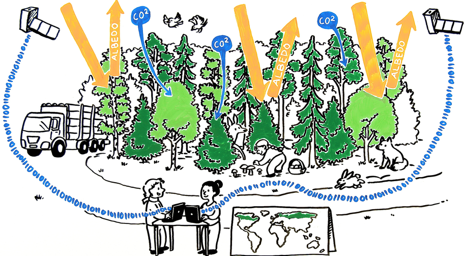
Image credits: Drawing by Tussitaikurit. Earth and satellite: ESA–J. Huart, CC BY-SA IGO 3.0.
Show other posts from this blog
Creating a checklist for a field work campaign
What’s there to consider when planning for a field campaign?
Kuusen neulaset heijastavat valoa samalla tavalla eri puolilla Eurooppaa
Tutkimus näytti ensimmäistä kertaa, että terveiden metsäkuusen neulasten spektriset ominaisuudet ovat samanlaisia eri puolilla Eurooppaa.
Vaikka Grönlanti sulaa, se ei nosta merenpintaa Suomessa
Grönlannin mannerjäätikön sulaminen nostaa valtamerien pintaa. Sulamisen seuraukset kuitenkin käytännössä kumoavat vaikutukset Suomessa.